For First Time Users
Nice to meet you! We are Agri Info Design, ltd.
We are a Japanese company developing the “AgriBus” series, a service that can easily reduce the burden and cost of farm work. On this page, we will explain the purpose of introducing the “AgriBus” series and how to start smart farming.
Purpose of introducing the AgriBus series
It can be used for the following applications
- Visualization of work trajectory
- Realization of one skip operation
- Tractor Automation
Visualization of work trajectory
The “Fill Trace” function allows you to know how far you have sprayed and where you will spray next in operations where you cannot see the “traces”, such as spraying fertilizeror pest control, raking a flooded rice field, or working at night. This enables us to prevent over-spraying and forgetting to spray, and to minimize overlap and overlapping.
Realization of one skip operation
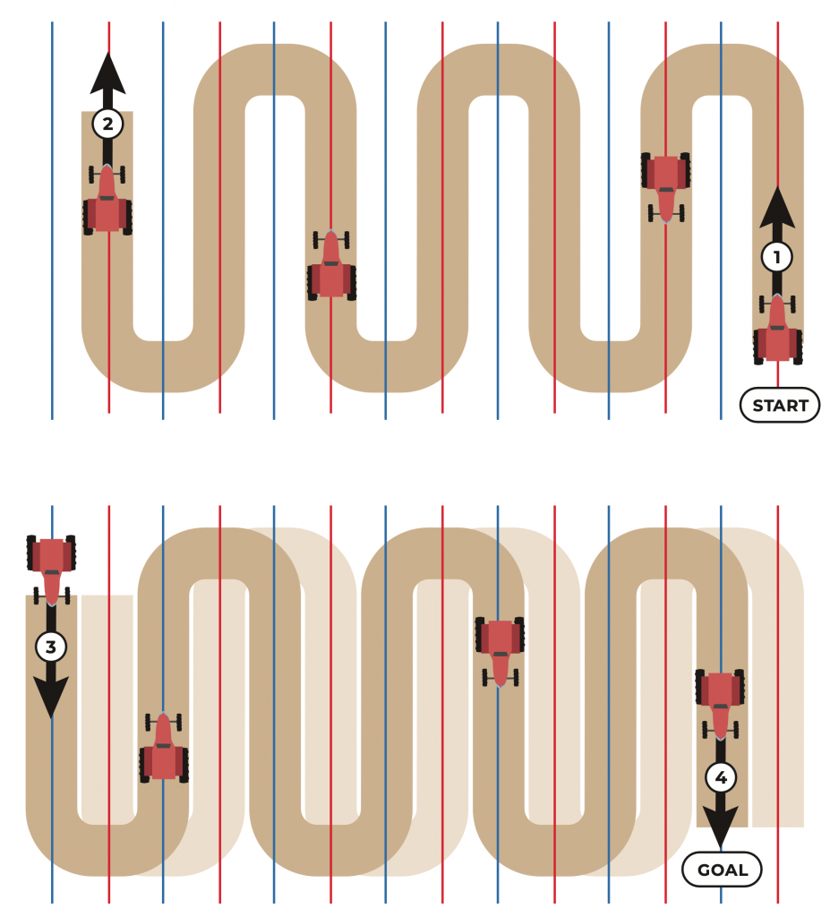
By defining the work line and identifying areas that have not yet been worked on, it is possible to skip one line (one process) .
One skip operation reduces the number of turnarounds in the sleeper area, which not only improves work efficiency but also reduces the burden on the transmission. It also reduces fuel consumption and CO2 emissions.
Tractor Automation
Eventually, it will be possible to automate tractors. Currently, the system supports automatic steering, which automates steering wheel operation. In the future, “AgriBus-G2 is planned to link vehicle speed with work equipment and ISOBUS with work equipment.
How to Start Smart Farming
- STEP1: Look at the trajectory with the fill function.
- STEP2: Try to skip a single straight line with straight guidance
- STEP3: Make your home “My Reference Station” and check the FIX
- STEP4: Realization of automatic steering
- STEP5: Management Kaizen through Agricultural DX
STEP1: Look at the trajectory with the fill function.
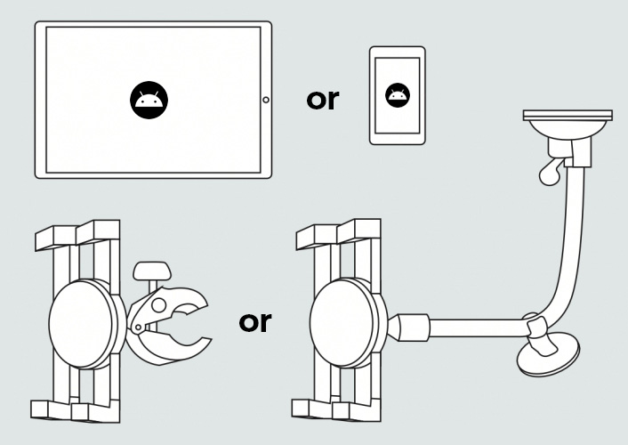
First, the “AgriBus-NAVI” application is basically the main application. The application can be downloaded for free, but you will need an Android device (smartphone or tablet) and an in-vehicle holder (the type that adheres to the windshield or the type that is held in place by a prop) to use it.

Download the “AgriBus-NAVI application here.

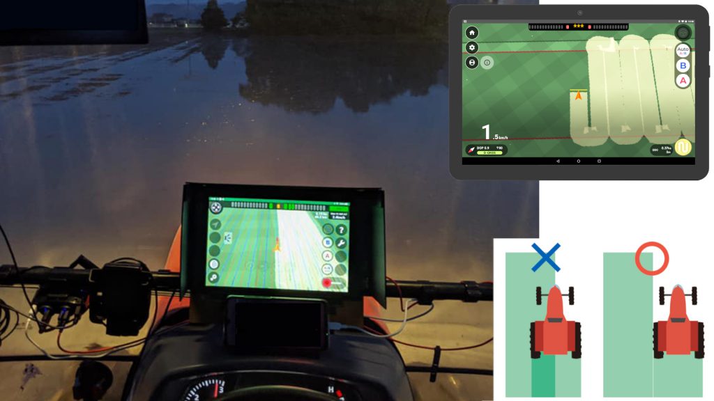
Please refer to the picture below for an image of the operation on the AgriBus-NAVI application screen. AgriBus-NAVI is useful in operations where “traces” cannot be seen, such as fertilizer application, pest control, paving, and night work. Prevent overspray and forgetting to spray by knowing how far you have sprayed and where to spray next. Minimize the number of overlaps. The button in the lower right corner of the screen allows you to switch on and off the paint application.
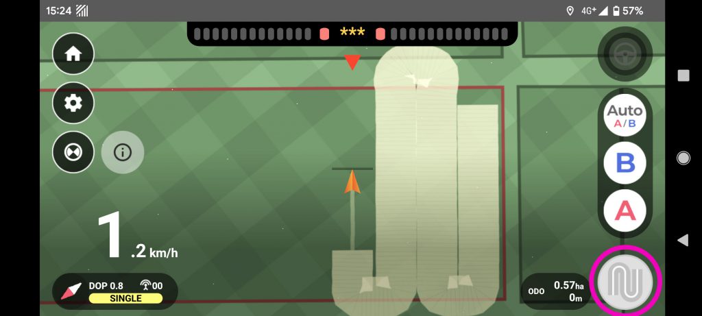
With the GPS sensor built into the smartphone, the status is “SINGLE: sole positioning”. The measurement error ranges from a few tens of centimeters to 20 meters.

STEP2: Try to skip a single straight line with straight guidance
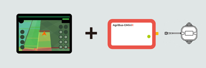
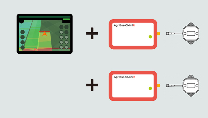
From STEP 2, the “AgriBus-GMiniR”, a Bluetooth-connected GPS receiver and antenna, is used because it requires a more accurate GPS than the smartphone’s built-in GPS sensor.
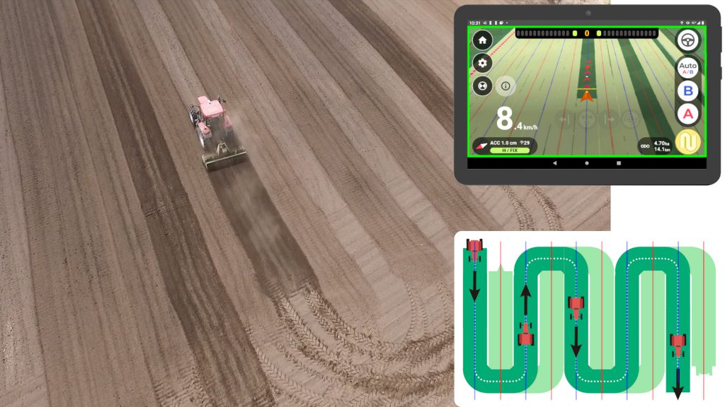
Straight line guidance is a system that assists the tractor to run straight and evenly spaced. As shown in the screen image below, by drawing a straight line called a “AB line” connecting point A and point B, the system guides the tractor to “run straight” and “enter the neighboring line” and also to “skip one line”.
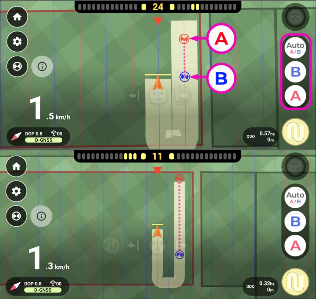
By skipping one line without having to enter an adjacent line, nonstop work is possible, with nonstop work lines. Non-stop work not only increases work efficiency, but also reduces the load on the transmission, improves fuel efficiency, and reduces greenhouse gases.
Advantages of single-skip operation
(1) Increased tractor life
(2) Increased work efficiency
(3) Improved fuel economy, reduced CO2 emissions
When “AgriBus-GMiniR” is used, the status becomes “D-GNSS: Differential Positioning”. The measurement error is about 20 to 30 cm.

STEP3: Make your home “My Reference Station” and check the FIX
In STEP3 and onward, since even higher accuracy GPS is required, a “reference station” for RTK will be a home or an office/garage. Since the reference station can be realized with “AgriBus-GMiniR, two reference stations will be used together with the one used in STEP2 for GPS reception (mobile station). The reference station you set up by yourself is called “My Reference Station” in AgriBus.
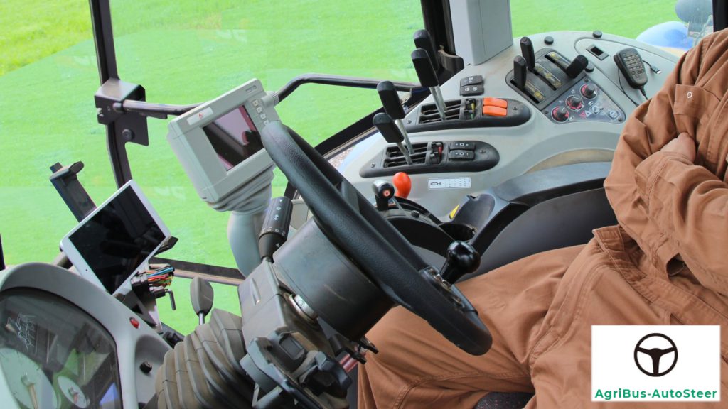
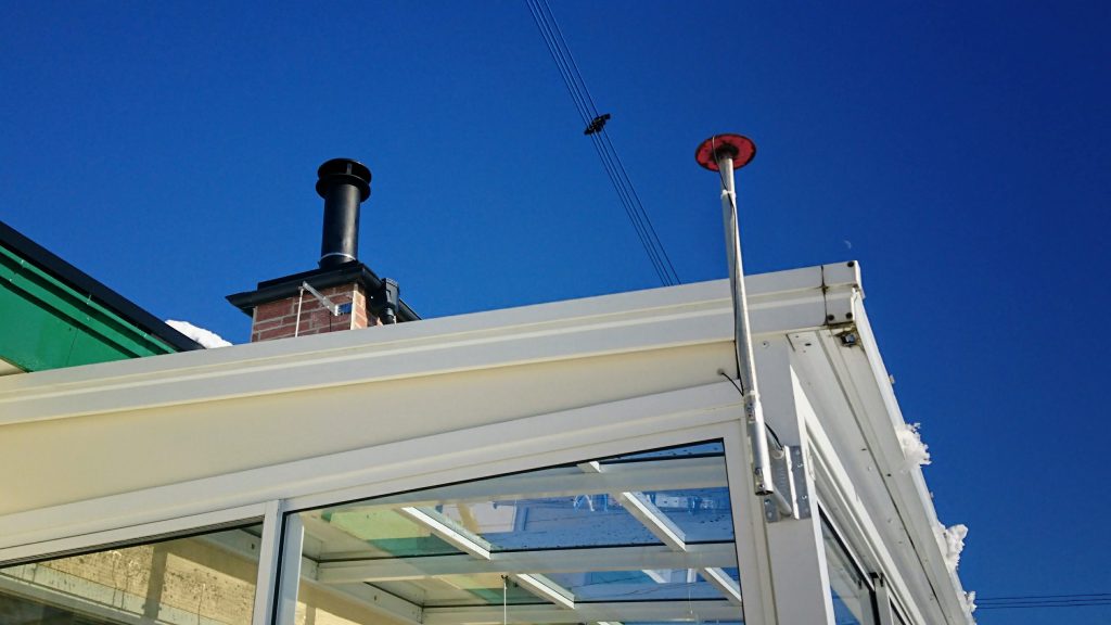
Click here to see an example of a “My Reference Station” installation. The main unit of “AgriBus-GMiniR is inside the house, while the antenna is on the roof with the cable extended. We recommend diverting the pedestal of a TV or CS antenna for installation.
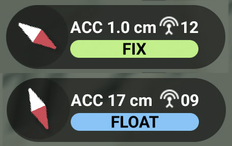
Once “My Reference Station” is operational, RTK will finally be realized and the status of “AgriBus-NAVI” will be “FIX” or “FLOAT”. The measurement error is 1 to 3 cm for FIX, and FLOAT means that an optimal solution has not been found during the calculation, which means the accuracy is not good.
Please note that a subscription to the paid plan [Plus] is required to operate “My Bureau of Standards”. Please refer to the link below for details.
Paid plans / Advanced navigation and work management functions – First time buyers get 30 days free on your subscription! You can cancel at any time.
 https://agri-info-design.com/en/plan-comparison-chart/
STEP4: Realization of automatic steering
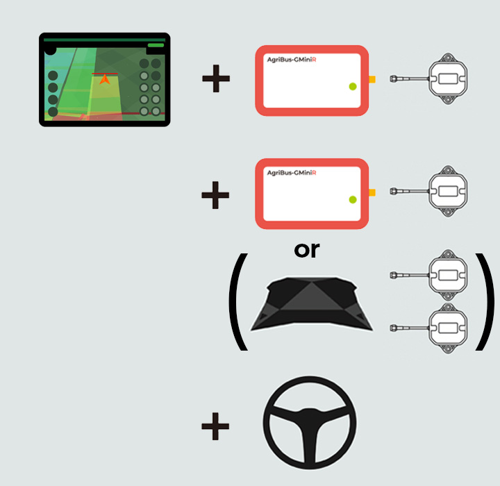
Once RTK is realized, GPS accuracy will be at a level where it is possible to move the tractor automatically. Here, the introduction of “AgriBus-AutoSteer” will enable automation of steering wheel operation. In addition, by upgrading the tractor’s GPS receiver to the “AgriBus-G2,” two antennas will increase stability at very low speeds/stops.
The tractor handle moves on its own to follow the “AB line” drawn in STEP 2. Long tapping the steering wheel button on the upper right toggles the automatic steering on and off.
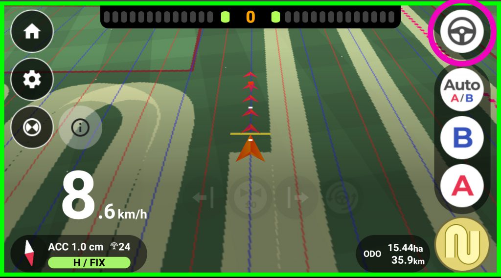
Only when “AgriBus-G2” is in use, the status becomes “H / FIX”. The “H” stands for “Heading” and means the direction in which the tractor is facing is detected using two antennas. This is the highest accuracy in this system.

STEP5: Management Kaizen through Agricultural DX
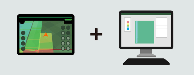
For users who work in an organized manner, such as agricultural corporations, we offer AgriBus-Web, which can manage data on a PC. Of course, users who wish to manage data alone can also use this service.
What you can do with the “AgriBus-Web” screen
- Create and manage fields, import (KML, Shapefile format), print
- Management and export of working data (our specified method)
- Management and import of AB line (Trimble CFX-750 format)
- Calculation of soil moisture and effective total temperature in conjunction with weather information
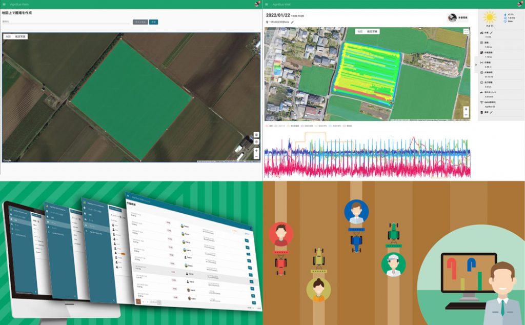
Through a Web browser to manage the field and work. You can automatically record the operation history from the AgriBus-NAVI application, create field areas using satellite photographs and 3D displays, and manage cropping records.
Please note that a subscription to the paid plan [Plus] is required to use “AgriBus-Web”. For details, please refer to the link below.
Paid plans / Advanced navigation and work management functions – First time buyers get 30 days free on your subscription! You can cancel at any time.