Today, the new version 3.9.6 of the AgriBus-NAVI app is now available on the Google Play Store.
The following functions have been added and changed. Please check these new features and changes if you are using the app.
release notes(3.9.6)
- Renewal of Tutorial
- New Operation Settings dialog and Saved Operation History dialog
- Newly added a dialog box for setting up reference lines and a list of saved reference lines.
- Improved auto-steering process
- Modification of GNSS installation attitude calculation method
- Ntrip client for non-bluetooth connected GNSS receivers
- Other bug fixes
Special note
Renewal of Tutorial
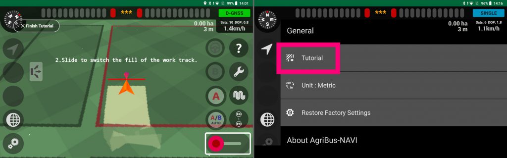
The demo mode, which used to be offered as a “demo mode” with sample data, has been reborn as a “tutorial”.
A step-by-step guide is now displayed and explained to help you learn how to use the app. You can now install the app or tap “Tutorial” from the settings screen to launch it.
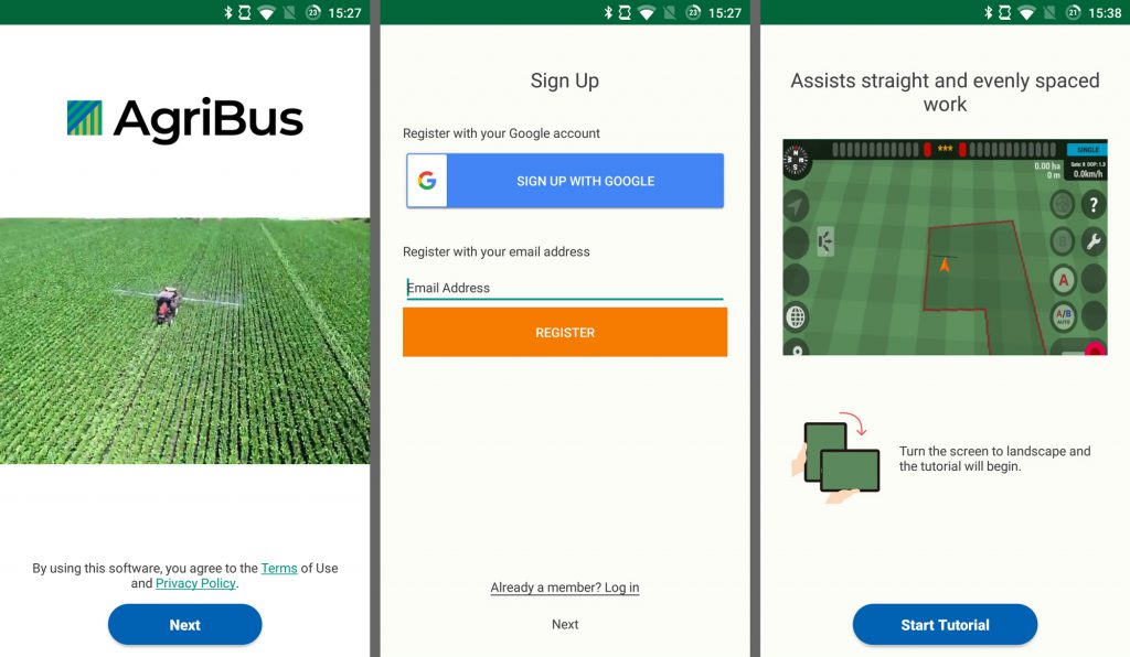
In addition, only the installation screen for new installations is compatible with the phone being held upright (displayed in portrait mode). We plan to increase the number of screens that support vertical orientation in the future.
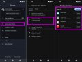
New Operation Settings dialog and Saved Operation History dialog
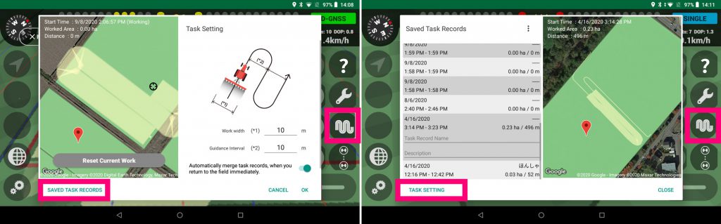
The “Working Width” and “Guidance Interval” settings, which were previously set from the “Field Setting Screen” on the right side of the navigation screen, are now located on the right side of the navigation screen for immediate activation.
The new settings screen allows you to view the current work in progress while looking at a satellite view of Google Maps, and to save or reset the work up to that point.
And we’ve added the following two new settings
- Automatically consolidate or not consolidate the work history when you return immediately after leaving the field.
- Make the color of past work tracks translucent or not
You can also switch to “Saved Operation History” by clicking on the button at the bottom left of the dialog to check the mapping of past operations to the satellite image on Google Maps.
The “L” and “R” work widths that existed as a setting item were actually not reflected internally and were meaningless, so we removed them.
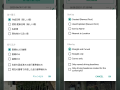
Newly added a dialog box for setting up reference lines and a list of saved reference lines.
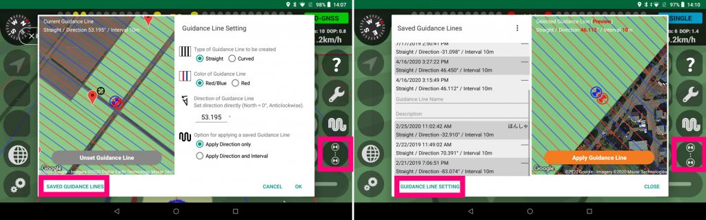
We have also consolidated the setting items related to the “Traveling Reference Line” from the “Field Setting” screen into a single dialog box.
On the new setting screen, you can view the current reference line from a Google Map and fine-tune the azimuth or cancel the setting.
And we’ve added the following two new options for applying the driving reference line
- Applicable to direction only
- Apply direction and guidance interval
If you switch to “Saved Reference Lines” from the button at the bottom left of the dialog, you will see a list of previously set reference lines (arranged in order of proximity to your current location), which you can check by mapping them to a satellite image on Google Maps and then apply them by simply pressing the button. We are in the
A subscription to the Standard Plan is required to use the functions related to stored driving reference lines.
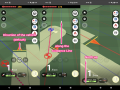
Improved auto-steering process
This update also includes a fix for AgriBus-AutoSteer control.
If the steering runout does not stop after the update, please try “Reset parameters”.
This is the content of this release.
If you have any questions about this release, please contact us. We welcome your comments and requests.
https://support.agri-info-design.com/
Click here to download the AgriBus-NAVI app
https://play.google.com/store/apps/details?id=com.agri_info_design.AgriBusNavi