Thank you for using AgriBus-NAVI app. We will inform you that the price of the standard plan has changed.
From January 1, 2020, AgriBus-NAVI will modify the price of the new standard plan application via Google Play to USD 109.99 per year. At the same time, a monthly plan (USD 10.99 per month) is set.
If you apply by December 31, 2019, please consider this opportunity as it will remain at the current rate (USD 60.00 per year) unless canceled.

– Price revision date:
January 1, 2020 (Wednesday)
– Target audience:
Those who newly apply for the Standard Plan via Google Play or re-contract after withdrawal
What you can do with the standard plan
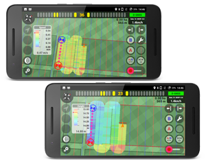
Unlocked feature
The following functions are unlocked by applying for the Standard Plan.
| Function | Content |
|---|---|
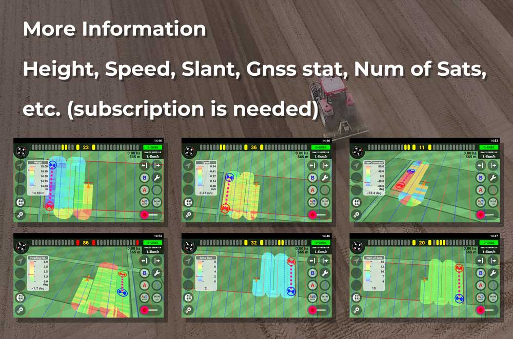
| Information Tray (*1) | Color-coded information such as height difference, tilt, speed, GNSS condition, and number of satellites is displayed on the information display tray (*1). |
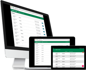
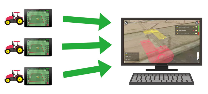
| Real-time display of vehicle position on AgriBus-Web (*2) | AgriBus-Web’s “Now” screen allows you to check the vehicle position in real time from your computer. |
| Storage in the AgriBus-Web | Data storage in the AgriBus-Web is indefinite (2 days if there is no standard plan contract). |
| Export data saved in AgriBus-Web | Export in TSV format and view with text editor or spreadsheet software |
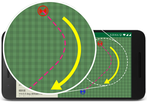
| Guidance reference lines | Saves the previously applied reference line and can be applied in the following operations. |
| Set up a guidance line saved nearby | You can extract and apply a list of saved guidance line near current location. |
| Curve guidance | In addition to linear guidance, guidance for curves is possible. |
| Multi-function buttons of the headset | You can assign function assignment and non-assignment to the multi-function buttons of the headset. |
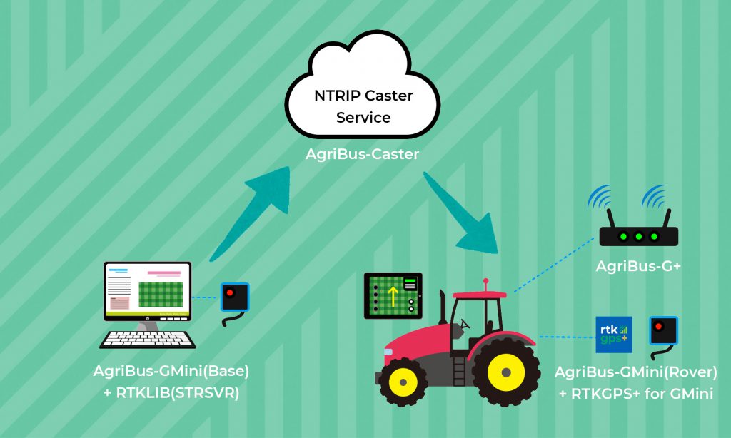
| Use of “AgriBus-Caster” (*3) | You can use the NTRIP Caster service to transfer correction information generated by the RTK-GNSS base station to the mobile station. |
About Information Tray (*1)
The GPS guidance displays real-time color-coded information such as height difference, tilt, speed, GNSS status, and number of satellites.
Real-time display of vehicle position on AgriBus-Web (*2)
If the vehicle position real-time display function “AgriBus-Now” is turned on, the current position of the vehicle can be confirmed from “AgriBus-Web”. Even if you own multiple tractors, you can have a bird’s-eye view of where each tractor is working.
Use of “AgriBus-Caster” (*3)
“AgriBus-Caster” is an NTRIP Caster service that can be used easily, easily and stably, and transfers correction information generated by the RTK-GNSS base station to the mobile station. Also supports RTK base stations other than “AgriBus-GMini / GMiniR”. The mobile station can receive with the “AgriBus-G+ / G2” and “RTKGPS+ for AgriBus-GMini” app.
Thank you for using AgriBus-NAVI app.