【AgriBus-Web】
Uploading KML/Shape files
TodayAgriBus-WebKML files (or KMZ files) and the ability to register fields by uploading Shapefile have been released.
While this function has been available in AgriBus-NAVI apps, there have been problems in that it takes time and effort to transfer KML/Shapefile data originally saved in a personal computer to a smartphone or tablet and upload the data to the smartphone or tablet, and it has not been possible to import the data according to the specifications of the Android.
Now, we can work on a personal computer by implementing it on the AgriBus-Web.Please try again.
In this blog,Google my mapThis section summarizes how to create KML files using KML files and how to upload KML files using AgriBus-Web.
If you already have KML files or Shapefile from a field,Uploading KML FilesYou can skip the reading.
How to Create KML Files on Google My Map
If you do not have KML/Shape files, you can create them on sites such as Google My Map.
Google My Map:
https://www.google.co.jp/intl/ja/maps/about/mymaps/

The above is the top screen.Click Start Using.
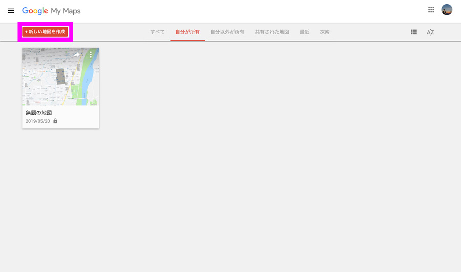
When you have logged in, click the red button in the upper left corner, Create a New Map.
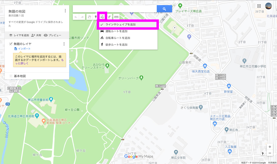
Then select Add Line or Shape from the tools below the search window.
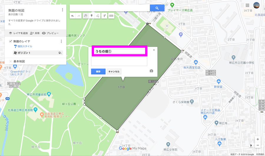
You can enter a name by clicking around the shape of the field.If you enter them here, they will be recognized later when you import them into the AgriBus-Web.
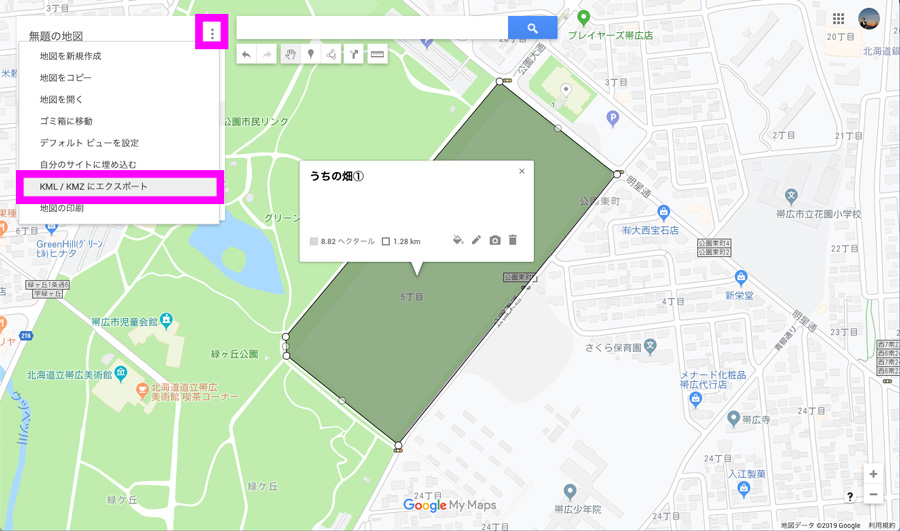
When you have a field, choose Export to KML/KMZ from the top-left menu.
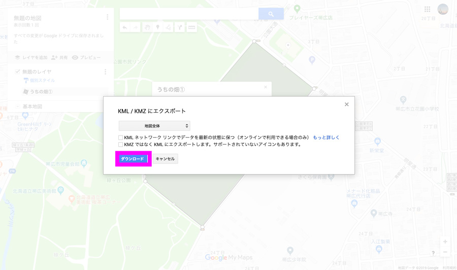
OK by “Download”.Note that both KML and KMZ files are supported.
This completes the description of the method of creating a KML file.Next, we will explain how to import the downloaded KML files into the AgriBus-Web.
Uploading KML Files
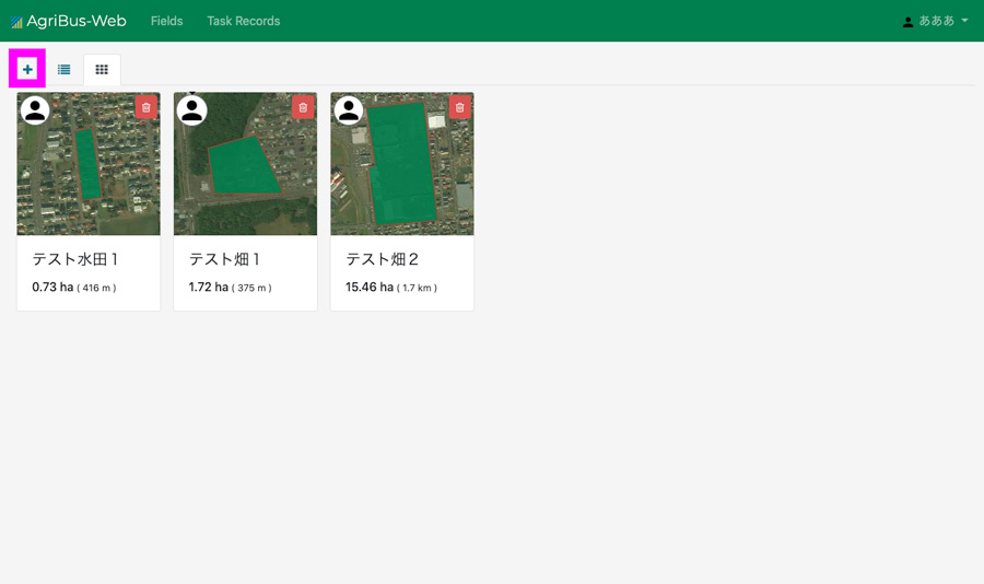
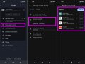
AgriBus-WebAfter logging in, the “+” button appears in the upper left corner.Click this.
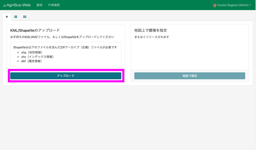
Then, the buttons for uploading the KML/Shapefile are displayed.On the right side of the menu, there is a menu called “Specify a field on a map.” This menu is a function of creating a field by clicking on a map like a Google map, and is currently being excellently developed.Please wait a little more.
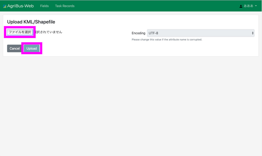
Select a file in the following window and send the file using “Upload”.
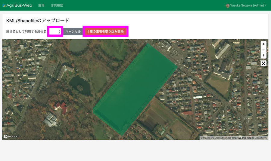
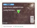
Then, the map of the KML file created above will appear.If “Name” is selected here, the field names entered in the Google mimap can be recognized and captured together.
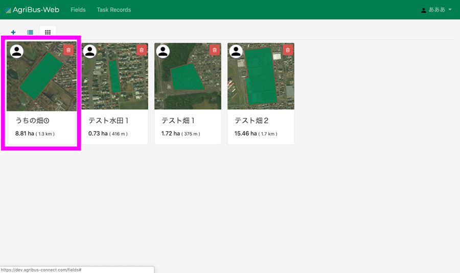
If you successfully capture by pressing the “Start Capture” button, the data captured in the field list should be displayed.
On small screens such as smartphones, it is difficult to do detailed work, and many people continue to use the AgriBus-NAVI without creating field data.
How can I use AgriBus-Web for this machine to manage field data and work history for the first time?
・ AgriBus-Web