AgriBus-Web field creation function
For the first time, Jin.
The Tokachi Hokkaido in Japan is a great harvest of potatoes. Last year I helped with harvesting by a nearby farmer’s harvester. Was another year passed?
Now, this is the subject. Today, we released a new field creation function in AgriBus-Web!
AgriBus-NAVI applications already have a “field creation function,” but we released this function on the AgriBus-Web in response to users’ requests that it is difficult to create a field with smartphones and tablets. This makes it possible to create a field on a PC.
■ Field preparation method
The method of making the field is very simple.
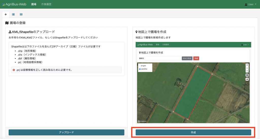
After logging in to the AgriBus-Web, click Create at the bottom right of the Field Registration window.
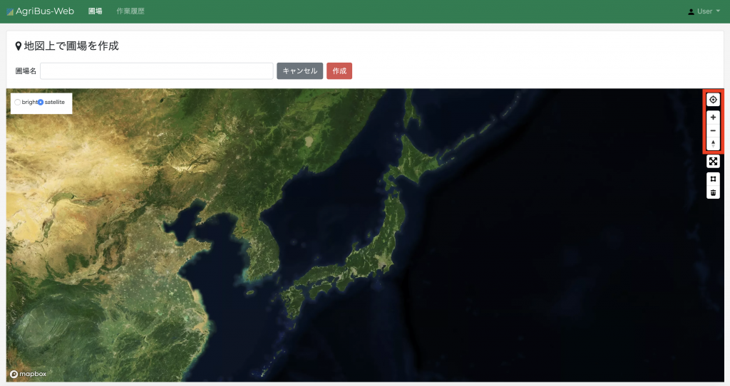
After the map is displayed, the field is displayed using the current position button at the upper right of the map and the zoom button.
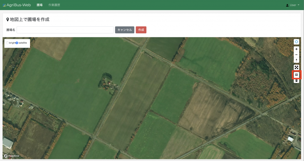
When the field is displayed, click the □ button at the upper right of the map to enter the field creation mode.
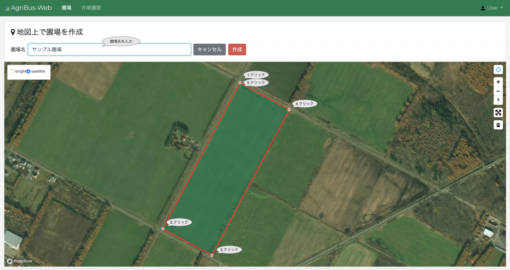
Click in order to surround the field. Finally, click the first click. The field shown in the figure above is square, but polygonal fields other than square can also be created. Then, enter the field name and click the Create button to complete the creation.
Until now, fields (KML files) have been created and uploaded by GoogleMyMaps and other means. However, by using the “Field Creation Function” released this time, fields can be created on AgriBus-Web maps. If you have not yet registered a field, use the “field creation function” released this time to register the field and manage the work history.