The genuine GNSS/GPS receiver optimized for the “AgriBus-NAVI” app describes the product of “AgriBus-GMini”, but how good is it? This time, I compared it with “GPS built-in smartphone”.
Comparing method
Use two smartphones with the AgriBus-NAVI app installed, one with a built-in GPS smartphone and the other with a AgriBus-GMini connected to the Bluetooth.
This time, we use a private car to browse around a broadband station, and verify what kind of differences exist in the trajectory and what differences are seen on the AgriBus-NAVI app screens.
The smartphone used is “Pixel 3 XL” and “Pixel 3a XL”, and the working area setting defaults to 10m.
This time, RTK is not used. It does nothing and verifies the AgriBus-GMini just after connecting it with the Bluetooth.
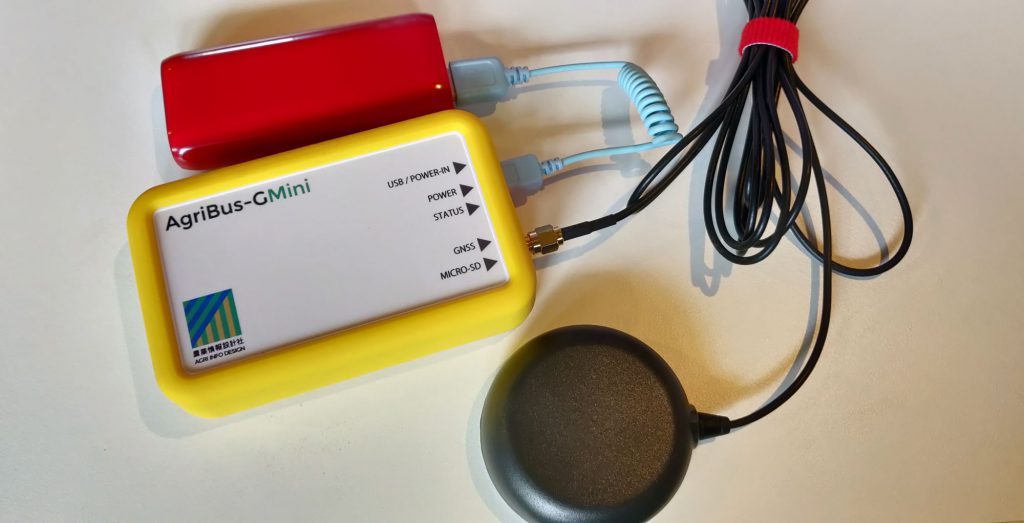
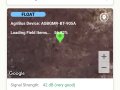
The AgriBus-GMini is powered on by a mobile battery. By using a short USB cable as shown in the image, only the antenna is connected to the wiring.
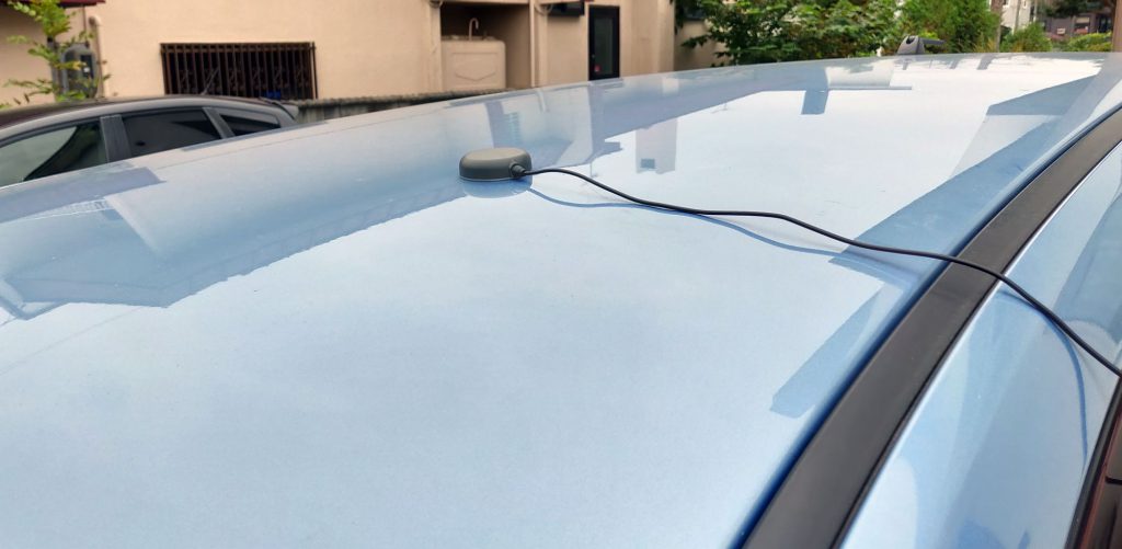
The antenna was mounted on a car. Magnetic stuck to the car body for convenience.
In this state, I ran the southern side of the broadband station (with maximum care in the safety plane).
Verification result
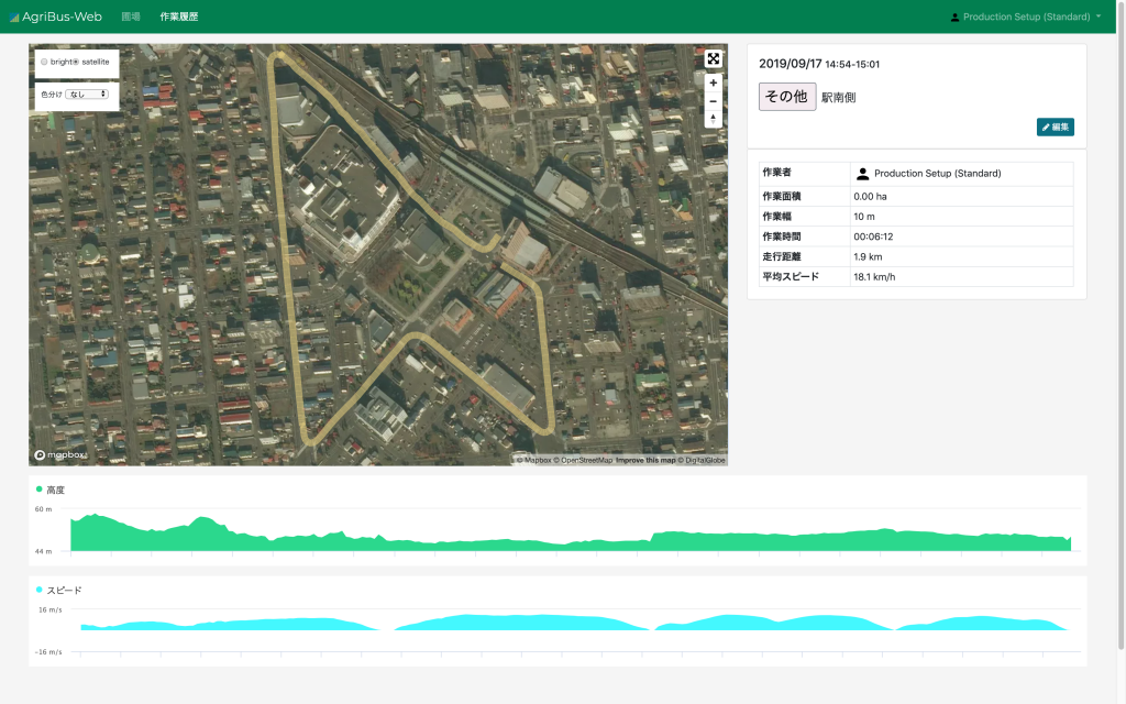
This is the AgriBus-Web history of the operations measured with the built-in GPS on the smartphone.
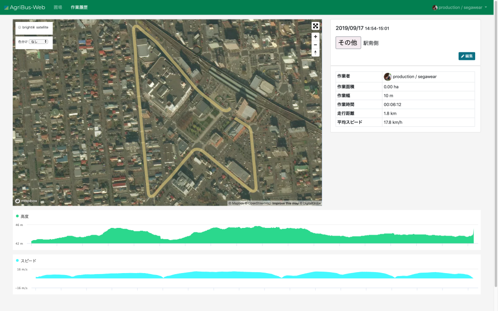
This is the AgriBus-GMini. Let’s zoom in.
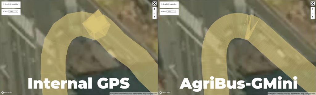
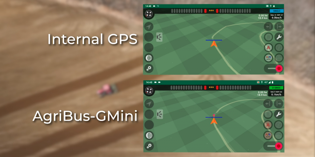
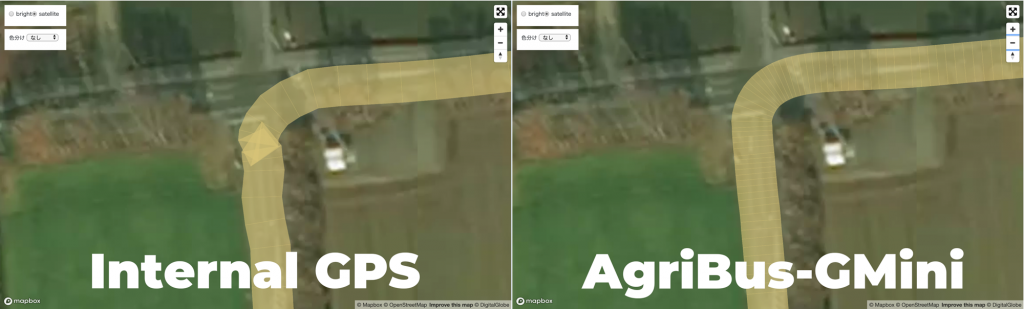
In the image above, we entered the intersection from the right, stopped waiting for a signal, and then turned left.
With the GPS built into a smartphone, you can see that the position of the car is shifted while waiting for a signal, and the work history is distorted.
The AgriBus-GMini continues to measure the same section, so there is little blur.
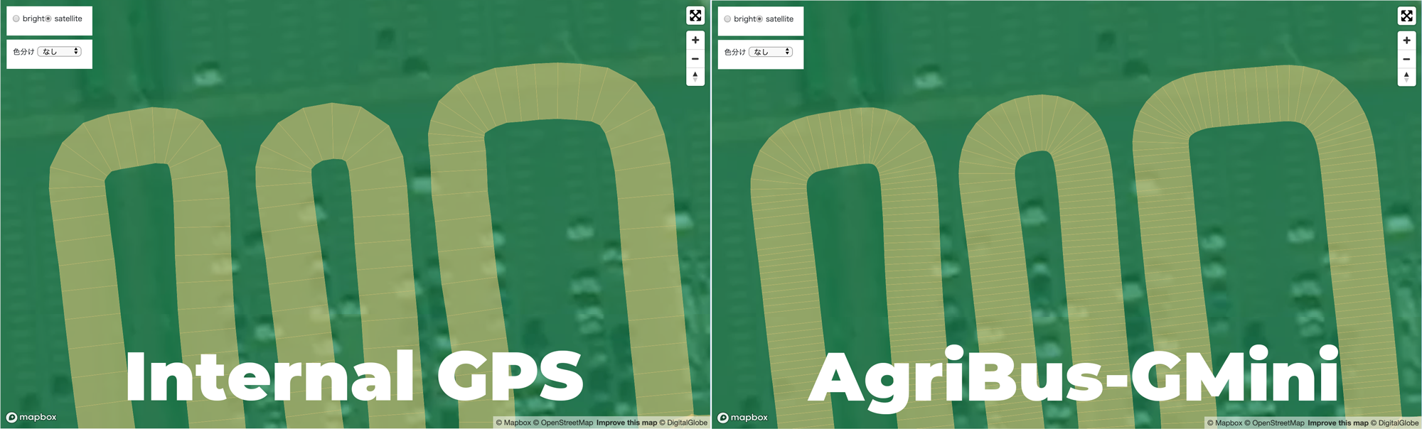
The image above shows a grouping of parking lots in a nearby gigantic shopping center.
The smartphone’s built-in GPS is good, but because of its faster sampling interval (shorter time to acquire signals), AgriBus-GMini records more data than the built-in GPS. If you zoom in on the image, you’ll see a smoother curve. (Click the above image to enlarge it.)
Exploring suburbs from broadband districts, we were able to run in the area where there were few buildings and explored.
There was also a difference when pausing. The AgriBus-GMini has a nicer curvature.
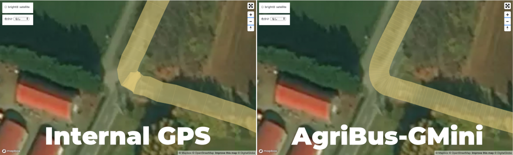
Another example is the right fold near a wind proof forest.
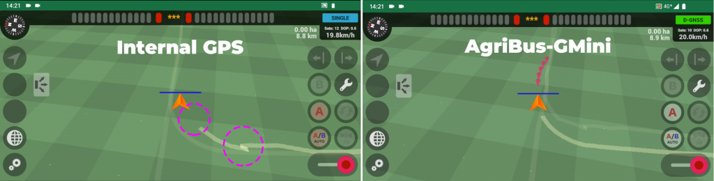
This is a screenshot of the AgriBus-NAVI app at that time.
If you use the GPS (built-in smartphone) on the left side of the image, you will notice that it is shaking when paused, and that there is no trajectory because the sampling interval is wide.
Verification video
This is the recording of the AgriBus-NAVI app screens as they were traversing around the bandwide stations.
Do you see the differences between the sample intervals? At the end of the video, you will notice that when you return to the rotary of the station, the AgriBus-GMini is still looking at the same point.
The red dot before the position of the vehicle is called the “prediction line”, but the direction in which the vehicle moves forward is predicted and displayed. This function is enabled only when AgriBus-GMini and AgriBus-G+ are connected.
Summary
It should be measured and the difference from the absolute position, but this time we looked at the difference between “smartphone built-in GPS” and “AgriBus-GMini” in the same situation.
By using the AgriBus-GMini, you can bring out the performance of the AgriBus-NAVI app, and as a result, you can create a good working history. If you want to be nearby when looking back at the work history later, you should.
Click here for AgriBus-GMini info.
AgriBus-GMini